
Olive Springs topographic map
Click on the map to display elevation.
About this map
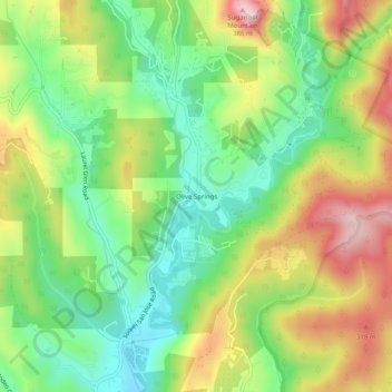
Name: Olive Springs topographic map, elevation, terrain.
Average elevation: 174 m
Minimum elevation: 34 m
Maximum elevation: 371 m
Other topographic maps
Click on a map to view its topography, its elevation and its terrain.
The Forest of Nisene Marks State Park
United States > California > Santa Cruz County > Day Valley
Average elevation: 237 m
Red, White and Blue Beach
United States > California > Santa Cruz County > Gordola
Average elevation: 26 m