
磯谷郡 topographic map
Interactive map
Click on the map to display elevation.
About this map
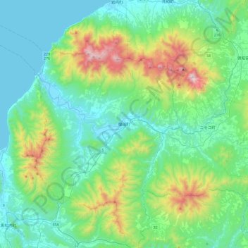
Name: 磯谷郡 topographic map, elevation, terrain.
Location: 蘭越町, 磯谷郡, 後志総合振興局, Prefectura de Hokkaidō, 北海道地方, Japón (42.63541 140.19549 42.98180 140.64325)
Average elevation: 275 m
Minimum elevation: -2 m
Maximum elevation: 1,294 m
Other topographic maps
Click on a map to view its topography, its elevation and its terrain.