
Noor topographic map
Interactive map
Click on the map to display elevation.
About this map
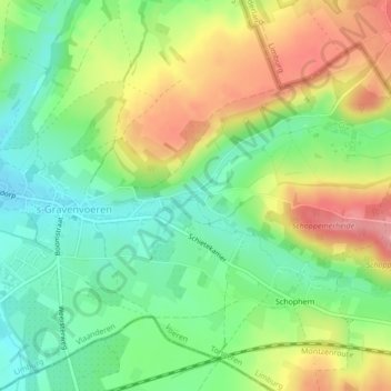
Name: Noor topographic map, elevation, terrain.
Location: Noor, Fourons, Tongres, Limbourg, Flandre, 3798, Belgique (50.75941 5.77462 50.76001 5.77604)
Average elevation: 126 m
Minimum elevation: 83 m
Maximum elevation: 185 m
Other topographic maps
Click on a map to view its topography, its elevation and its terrain.