Geolocate

Pachacayo topographic map

Click on the map to display elevation.

About this map

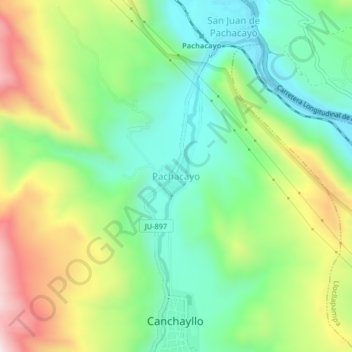
Name: Pachacayo topographic map, elevation, terrain.

Location: Pachacayo, Canchayllo, Jauja, Junín, Perú (-11.80540 -75.73765 -11.76540 -75.69765)

Average elevation: 3,722 m

Minimum elevation: 3,508 m

Maximum elevation: 4,087 m

Gear up for your next adventure:

🧢Outdoor Cap - Protective cap for sun and rain during hikes
🛶Waterproof Dry Bags - Keep electronics and clothes dry during river crossings
🐕Hiking Dog Pack - Let your canine companion carry their own water and food
🥾Mountain Hiking Shoes - Shoes with superior grip for mountainous terrain
🗺️Topographic Maps - Detailed maps to explore trails, mountains, and wilderness areas

As an Amazon Associate, this site earns from qualifying purchases at no extra cost to you.