Geolocate

Umred topographic map

Click on the map to display elevation.

About this map

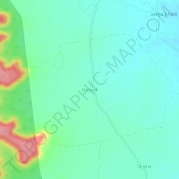
Name: Umred topographic map, elevation, terrain.

Location: Umred, Biaora Tahsil, Rajgarh District, Madhya Pradesh, India (23.82412 77.11259 23.86412 77.15259)

Average elevation: 456 m

Minimum elevation: 430 m

Maximum elevation: 538 m

Other topographic maps

Click on a map to view its topography, its elevation and its terrain.

Agar

India > Madhya Pradesh > Biaora Tahsil

Average elevation: 471 m

Gear up for your next adventure:

🏃Hydration Running Vest - Carry water and maps close to your body for speed
🧦Thermal Socks - Warm socks for winter hiking or camping
👟Sport Hiking Sandals - Breathable footwear for water crossings and camp rest
🐕Hiking Dog Pack - Let your canine companion carry their own water and food
🪑Insulated Seat Pad - Protect your seat from cold rocks and wet logs

As an Amazon Associate, this site earns from qualifying purchases at no extra cost to you.