Geolocate

Eridu topographic map

Click on the map to display elevation.

About this map

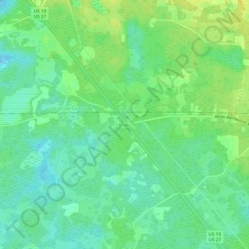
Name: Eridu topographic map, elevation, terrain.

Location: Eridu, Taylor County, Florida, United States (30.28187 -83.76720 30.32187 -83.72720)

Average elevation: 19 m

Minimum elevation: 9 m

Maximum elevation: 29 m

Gear up for your next adventure:

🧥Waterproof Hiking Jacket - Protect yourself from rain and wind while hiking
🌬️Windproof Camp Stove - Efficient cooking even on exposed mountain peaks
Camping Essentials - All-in-one gear for a comfortable camping trip
💡Compact LED Flashlight - Powerful and portable flashlight for outdoor use
🧤Thermal Hiking Gloves - Grip-enhanced gloves for cold-weather altitude trekking

As an Amazon Associate, this site earns from qualifying purchases at no extra cost to you.