
Thank you for supporting this site ❤️
Make a donation
Make a donation
Gear up for your next adventure:
As an Amazon Associate, this site earns from qualifying purchases at no extra cost to you.
Odland topographic map
Click on the map to display elevation.
Thank you for supporting this site ❤️
Make a donation
Make a donation
Gear up for your next adventure:
As an Amazon Associate, this site earns from qualifying purchases at no extra cost to you.
About this map
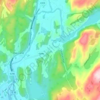
Name: Odland topographic map, elevation, terrain.
Location: Odland, Røysland, Bjerkreim, Rogaland, 4387, Norway (58.56601 6.07380 58.60601 6.11380)
Average elevation: 133 m
Minimum elevation: 39 m
Maximum elevation: 388 m
Thank you for supporting this site ❤️
Make a donation
Make a donation
Gear up for your next adventure:
As an Amazon Associate, this site earns from qualifying purchases at no extra cost to you.