
Thank you for supporting this site ❤️
Make a donation
Make a donation
Gear up for your next adventure:
As an Amazon Associate, this site earns from qualifying purchases at no extra cost to you.
Bettmeralp topographic map
Click on the map to display elevation.
Thank you for supporting this site ❤️
Make a donation
Make a donation
Gear up for your next adventure:
As an Amazon Associate, this site earns from qualifying purchases at no extra cost to you.
About this map
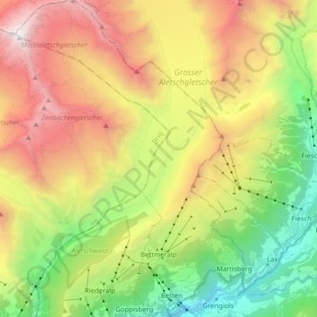
Name: Bettmeralp topographic map, elevation, terrain.
Location: Bettmeralp, Östlich Raron, Wallis, 3992, Switzerland (46.36893 7.99166 46.47802 8.10608)
Average elevation: 2,259 m
Minimum elevation: 815 m
Maximum elevation: 4,159 m
Thank you for supporting this site ❤️
Make a donation
Make a donation
Gear up for your next adventure:
As an Amazon Associate, this site earns from qualifying purchases at no extra cost to you.