Geolocate

Mestas topographic map

Click on the map to display elevation.

About this map

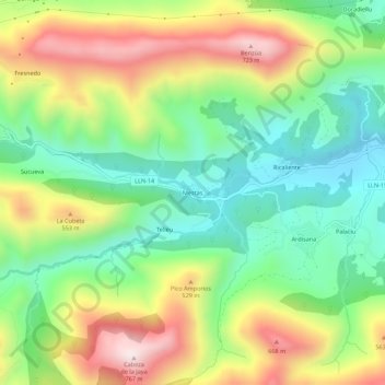
Name: Mestas topographic map, elevation, terrain.

Location: Mestas, Llanes, Asturias, España (43.37113 -4.97887 43.41113 -4.93887)

Average elevation: 340 m

Minimum elevation: 72 m

Maximum elevation: 744 m

Other topographic maps

Click on a map to view its topography, its elevation and its terrain.

Meré

España > Asturias > Llanes

Average elevation: 351 m

Río de Nueva

España > Asturias > Llanes > Picones

Average elevation: 25 m

Gear up for your next adventure:

🥾Trail Hiking Boots - Supportive boots for rough trails
🧴First Aid Kit - Essential first aid supplies for outdoor emergencies
💧Filtered Water Bottle - Safe drinking water on the go
🥘Camping Cookware Set - Compact nesting pots and pans for trail cooking
🧤Thermal Hiking Gloves - Grip-enhanced gloves for cold-weather altitude trekking

As an Amazon Associate, this site earns from qualifying purchases at no extra cost to you.