
Sant'Agnello topographic map
Interactive map
Click on the map to display elevation.
About this map
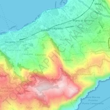
Name: Sant'Agnello topographic map, elevation, terrain.
Location: Sant'Agnello, Nápoles, Campania, 80065, Italia (40.59933 14.38816 40.64065 14.41901)
Average elevation: 191 m
Minimum elevation: -3 m
Maximum elevation: 529 m
Other topographic maps
Click on a map to view its topography, its elevation and its terrain.