
Thank you for supporting this site ❤️
Make a donation
Make a donation
Gear up for your next adventure:
As an Amazon Associate, this site earns from qualifying purchases at no extra cost to you.
Cando topographic map
Click on the map to display elevation.
Thank you for supporting this site ❤️
Make a donation
Make a donation
Gear up for your next adventure:
As an Amazon Associate, this site earns from qualifying purchases at no extra cost to you.
About this map
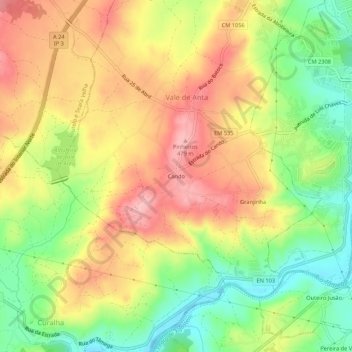
Name: Cando topographic map, elevation, terrain.
Location: Cando, Vale de Anta, Chaves, Vila Real, 5400-581, Portugal (41.71222 -7.52463 41.75222 -7.48463)
Average elevation: 409 m
Minimum elevation: 337 m
Maximum elevation: 476 m
Thank you for supporting this site ❤️
Make a donation
Make a donation
Gear up for your next adventure:
As an Amazon Associate, this site earns from qualifying purchases at no extra cost to you.