
Thank you for supporting this site ❤️
Make a donation
Make a donation
Gear up for your next adventure:
As an Amazon Associate, this site earns from qualifying purchases at no extra cost to you.
Mna topographic map
Click on the map to display elevation.
Thank you for supporting this site ❤️
Make a donation
Make a donation
Gear up for your next adventure:
As an Amazon Associate, this site earns from qualifying purchases at no extra cost to you.
About this map
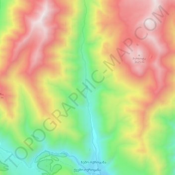
Name: Mna topographic map, elevation, terrain.
Location: Mna, Kazbegi Municipality, Mtskheta-Mtianeti, Georgia (42.58059 44.45854 42.65859 44.47068)
Average elevation: 2,826 m
Minimum elevation: 2,007 m
Maximum elevation: 3,701 m
Thank you for supporting this site ❤️
Make a donation
Make a donation
Gear up for your next adventure:
As an Amazon Associate, this site earns from qualifying purchases at no extra cost to you.