

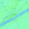
Tembilahan topographic map
Click on the map to display elevation.
Tembilahan
The soil conditions of the area is mostly composed of peat soil and stream sediment and marshes. The altitude of the District's Government's Centre is from 1 to 4 metres (3 to 13 ft). On the banks of the rivers and in the estuaries trenches there are many plants that grow, such as Nipah trees.
About this map

Name: Tembilahan topographic map, elevation, terrain.
Location: Tembilahan, Indragiri Hilir, Riau, Indonesia (-0.43217 103.10849 -0.26717 103.24605)
Average elevation: 4 m
Minimum elevation: -4 m
Maximum elevation: 11 m
Other topographic maps
Click on a map to view its topography, its elevation and its terrain.

Tembilahan
Indonesia > Riau > Indragiri Hilir
The soil conditions of the area is mostly composed of peat soil and stream sediment and marshes. The altitude of the District's Government's Centre is from 1 to 4 metres. On the banks of the rivers and in the estuaries trenches there are many plants that grow, such as Nipah trees.
Average elevation: 4 m

