Geolocate

Barkhamsted topographic map

Click on the map to display elevation.

About this map

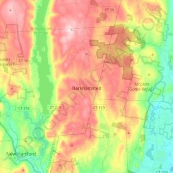
Name: Barkhamsted topographic map, elevation, terrain.

Location: Barkhamsted, Northwest Hills COG, Connecticut, United States (41.88728 -73.05365 41.97341 -72.88770)

Average elevation: 238 m

Minimum elevation: 69 m

Maximum elevation: 422 m

Gear up for your next adventure:

Camping Coffee Maker - Brew fresh coffee anywhere on the topographic map
🧰Emergency Multi-Tool - Compact multi-tool for outdoor survival
🧰Multitool Knife - Compact and versatile tool for outdoor use
🔦LED Headtorch - Bright and durable light for night activities
🥾Trail Hiking Socks - Comfortable socks to prevent blisters and fatigue

As an Amazon Associate, this site earns from qualifying purchases at no extra cost to you.