Geolocate

Lucas topographic map

Click on the map to display elevation.

About this map

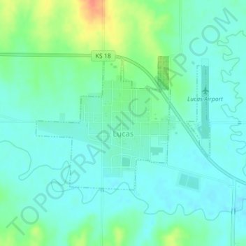
Name: Lucas topographic map, elevation, terrain.

Location: Lucas, Russell County, Kansas, United States (39.05206 -98.55012 39.06674 -98.52552)

Average elevation: 458 m

Minimum elevation: 446 m

Maximum elevation: 492 m

Gear up for your next adventure:

🕶️Polarized Sunglasses - Reduces glare from snow and water at high elevations
🧥Waterproof Hiking Jacket - Protect yourself from rain and wind while hiking
🧤Thermal Hiking Gloves - Grip-enhanced gloves for cold-weather altitude trekking
🍽️Titanium Camping Spork - Ultralight and indestructible eating utensil
🦶Anti-Blister Balm - Prevents friction and hotspots during long ascents

As an Amazon Associate, this site earns from qualifying purchases at no extra cost to you.