Geolocate

Bangsri topographic map

Click on the map to display elevation.

About this map

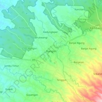
Name: Bangsri topographic map, elevation, terrain.

Location: Bangsri, Jepara, Central Java, Java, 59452, Indonesia (-6.56333 110.72716 -6.48333 110.80716)

Average elevation: 92 m

Minimum elevation: 13 m

Maximum elevation: 297 m

Gear up for your next adventure:

🥾Approach Boots - Comfortable boots for hiking and climbing approaches
🥫Freeze-Dried Meals - Lightweight, high-calorie nutrition for multi-day treks
🧤Thermal Hiking Gloves - Grip-enhanced gloves for cold-weather altitude trekking
💧Hydration Bladder - Hands-free hydration solution for long treks
🕶️Polarized Sunglasses - Protect your eyes with durable polarized lenses

As an Amazon Associate, this site earns from qualifying purchases at no extra cost to you.