
Make a donation
Gear up for your next adventure:
As an Amazon Associate, this site earns from qualifying purchases at no extra cost to you.
Bothfeld topographic map
Click on the map to display elevation.
Make a donation
Gear up for your next adventure:
As an Amazon Associate, this site earns from qualifying purchases at no extra cost to you.
About this map
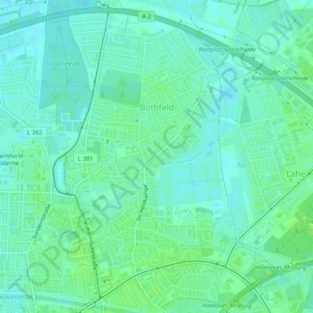
Name: Bothfeld topographic map, elevation, terrain.
Average elevation: 56 m
Minimum elevation: 51 m
Maximum elevation: 60 m
Make a donation
Gear up for your next adventure:
As an Amazon Associate, this site earns from qualifying purchases at no extra cost to you.
Other topographic maps
Click on a map to view its topography, its elevation and its terrain.
Hannover
Deutschland > Niedersachsen > Region Hannover > Hannover
Von Süden her kommend fließt die Leine durch Hannover nordwestlich in Richtung Aller. In Höhe des Maschsees wird über den Schnellen Graben Leinewasser zur Ihme geleitet. Das dortige Wehr dient neben der Regulierung des Wasserstandes der Stromerzeugung. Die Ihme ist ein kleiner Bach, der aus dem Calenberger…
Average elevation: 70 m