Geolocate

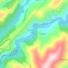
Labayos topographic map

Click on the map to display elevation.

About this map

Name: Labayos topographic map, elevation, terrain.

Location: Labayos, Cangas del Narcea, Asturias, España (43.08810 -6.56653 43.12810 -6.52653)

Average elevation: 821 m

Minimum elevation: 431 m

Maximum elevation: 1,300 m

Other topographic maps

Click on a map to view its topography, its elevation and its terrain.
Gear up for your next adventure:

🧣Evaporative Cooling Towel - Beat the heat during intense summer climbs
🛶Canoe Life Vest - Safety vest for water sports
💧Hydration Pack - Hands-free hydration system for long hikes
🧥Waterproof Jacket - Lightweight rain jackets for hiking and outdoor activities
🪜Heavy Duty Carabiners - Multi-use clips for securing gear to your backpack

As an Amazon Associate, this site earns from qualifying purchases at no extra cost to you.