
Port Mathurin topographic map
Interactive map
Click on the map to display elevation.
About this map
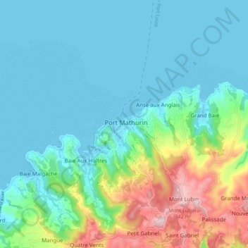
Name: Port Mathurin topographic map, elevation, terrain.
Location: Port Mathurin, Rodrigues, Mauritius (-19.72130 63.38149 -19.64130 63.46149)
Average elevation: 85 m
Minimum elevation: -1 m
Maximum elevation: 386 m