Geolocate

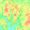
Tatum topographic map

Click on the map to display elevation.

About this map

Name: Tatum topographic map, elevation, terrain.

Location: Tatum, Rusk County, Texas, 75691, United States (32.29888 -94.53581 32.33213 -94.49952)

Average elevation: 99 m

Minimum elevation: 75 m

Maximum elevation: 119 m

Other topographic maps

Click on a map to view its topography, its elevation and its terrain.

Cambell Branch

United States > Texas > Rusk County

Average elevation: 94 m

Oak Hill

United States > Texas > Rusk County

Average elevation: 131 m

Henderson

United States > Texas > Rusk County > Henderson > Henderson

Average elevation: 139 m

Laneville

United States > Texas > Rusk County

Average elevation: 124 m

Gear up for your next adventure:

❄️Traction Ice Cleats - Slip-on spikes for icy trails and winter hiking
🧥Waterproof Jacket - Lightweight rain jackets for hiking and outdoor activities
🩹Compact First Aid Kit - Pre-packed essentials for common trail injuries
🛶Kayak Accessories - Essential gear for safe and fun kayaking adventures
💧Reusable Water Bottle - Durable water bottles for hydration on trails

As an Amazon Associate, this site earns from qualifying purchases at no extra cost to you.