
Ligny topographic map
Interactive map
Click on the map to display elevation.
About this map
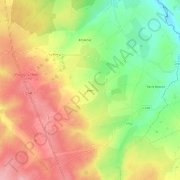
Name: Ligny topographic map, elevation, terrain.
Average elevation: 318 m
Minimum elevation: 239 m
Maximum elevation: 386 m
Other topographic maps
Click on a map to view its topography, its elevation and its terrain.
Terrier Randoin
France > Centre-Val de Loire > Indre > Pouligny-Notre-Dame
Terrier Randoin, Pouligny-Notre-Dame, La Châtre, Indre, Centre-Val de Loire, France métropolitaine, 36160, France
Average elevation: 404 m