
Thank you for supporting this site ❤️
Make a donation
Make a donation
Gear up for your next adventure:
As an Amazon Associate, this site earns from qualifying purchases at no extra cost to you.
L'Escuredal topographic map
Click on the map to display elevation.
Thank you for supporting this site ❤️
Make a donation
Make a donation
Gear up for your next adventure:
As an Amazon Associate, this site earns from qualifying purchases at no extra cost to you.
About this map
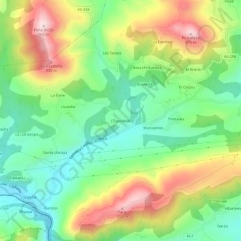
Name: L'Escuredal topographic map, elevation, terrain.
Location: L'Escuredal, Pintueles, Piloña, 22534, España (43.35558 -5.38710 43.39558 -5.34710)
Average elevation: 316 m
Minimum elevation: 155 m
Maximum elevation: 562 m
Thank you for supporting this site ❤️
Make a donation
Make a donation
Gear up for your next adventure:
As an Amazon Associate, this site earns from qualifying purchases at no extra cost to you.