
Tủa Chùa topographic map
Interactive map
Click on the map to display elevation.
About this map
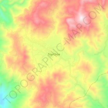
Name: Tủa Chùa topographic map, elevation, terrain.
Location: Tủa Chùa, Province de Điện Biên, Viêt Nam (21.80891 103.31323 21.88891 103.39323)
Average elevation: 910 m
Minimum elevation: 289 m
Maximum elevation: 1,453 m