
Washburn Island topographic map
Interactive map
Click on the map to display elevation.
About this map
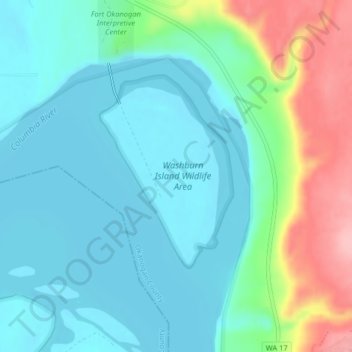
Name: Washburn Island topographic map, elevation, terrain.
Average elevation: 271 m
Minimum elevation: 235 m
Maximum elevation: 379 m
Other topographic maps
Click on a map to view its topography, its elevation and its terrain.
White Lakes
United States > Washington > Okanogan County
White Lakes, Okanogan County, Washington, United States
Average elevation: 1,979 m
Brown Lake
United States > Washington > Okanogan County > Brown Lake
Brown Lake, Okanogan County, Okanogan, Washington, United States
Average elevation: 719 m