Geolocate

Sector 2 topographic map

Click on the map to display elevation.

About this map

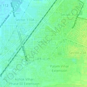
Name: Sector 2 topographic map, elevation, terrain.

Location: Sector 2, Gurgaon, Gurugram, Haryana, India (28.50211 77.02467 28.51489 77.04179)

Average elevation: 219 m

Minimum elevation: 212 m

Maximum elevation: 226 m

Other topographic maps

Click on a map to view its topography, its elevation and its terrain.

Sultanpur National Park

India > Haryana > Gurugram

Average elevation: 216 m

Wazirabad

India > Haryana > Gurugram

Average elevation: 241 m

Gear up for your next adventure:

Lightweight Camping Tent - Portable shelter optimized for Canadian backcountry camping
🥾All-Terrain Hiking Boots - Versatile boots for varied hiking conditions
🧭Orienteering Kit - Tools for map reading and navigation in the wild
🧤Thermal Hiking Gloves - Grip-enhanced gloves for cold-weather altitude trekking
🧣Merino Neck Gaiter - Protects against wind, sun, and cold at high altitudes

As an Amazon Associate, this site earns from qualifying purchases at no extra cost to you.