Geolocate

Balata topographic map

Click on the map to display elevation.

About this map

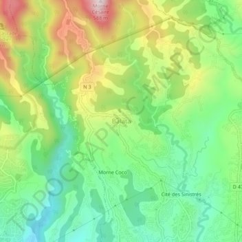
Name: Balata topographic map, elevation, terrain.

Location: Balata, Fort-de-France, Martinique, 97234, France (14.62878 -61.09946 14.66878 -61.05946)

Average elevation: 231 m

Minimum elevation: 29 m

Maximum elevation: 563 m

Gear up for your next adventure:

🔭Outdoor Binoculars - Lightweight binoculars for birdwatching and hiking
Camping Tent - Weather-resistant tents suitable for 2 to 6 people
🦶Anti-Blister Balm - Prevents friction and hotspots during long ascents
🧭GPS Handheld Device - Reliable GPS navigation for outdoor adventures
🧥Softshell Hiking Jacket - The perfect balance of wind protection and breathability

As an Amazon Associate, this site earns from qualifying purchases at no extra cost to you.