Geolocate

Surajgarha topographic map

Click on the map to display elevation.

About this map

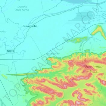
Name: Surajgarha topographic map, elevation, terrain.

Location: Surajgarha, Lakhisarai, Bihar, India (25.07592 86.10971 25.29810 86.39174)

Average elevation: 108 m

Minimum elevation: 30 m

Maximum elevation: 474 m

Gear up for your next adventure:

🚲Handlebar Phone Mount - View topographic-map.com live while cycling
🧦Merino Wool Socks - Moisture-wicking comfort for long-distance hiking
🦶Anti-Blister Balm - Prevents friction and hotspots during long ascents
🧦Outdoor Socks - Durable socks designed for hiking and outdoor sports
🕶️Polarized Sunglasses - Reduces glare from snow and water at high elevations

As an Amazon Associate, this site earns from qualifying purchases at no extra cost to you.