
Make a donation
Gear up for your next adventure:
As an Amazon Associate, this site earns from qualifying purchases at no extra cost to you.
Jezus-Eik topographic map
Click on the map to display elevation.
Make a donation
Gear up for your next adventure:
As an Amazon Associate, this site earns from qualifying purchases at no extra cost to you.
Jezus-Eik
Jezus-Eik ligt aan de zuidrand van het Zoniënwoud op een hoogte van 80-122 meter. De plaats is ontstaan daar waar begin 19e eeuw de zuidrand van het Zoniënwoud werd verkaveld. Het belangrijkste natuurgebied is het Marnixbos, behorend bij het Kasteel de Marnix.
Make a donation
Gear up for your next adventure:
As an Amazon Associate, this site earns from qualifying purchases at no extra cost to you.
About this map
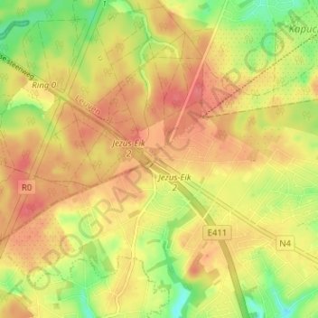
Name: Jezus-Eik topographic map, elevation, terrain.
Average elevation: 109 m
Minimum elevation: 71 m
Maximum elevation: 133 m
Make a donation
Gear up for your next adventure:
As an Amazon Associate, this site earns from qualifying purchases at no extra cost to you.
Other topographic maps
Click on a map to view its topography, its elevation and its terrain.