Geolocate

Modi topographic map

Click on the map to display elevation.

About this map

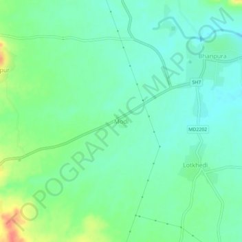
Name: Modi topographic map, elevation, terrain.

Location: Modi, Bhanpura Tahsil, Mandsaur, Madhya Pradesh, 458775, India (24.48160 75.70902 24.52160 75.74902)

Average elevation: 401 m

Minimum elevation: 384 m

Maximum elevation: 439 m

Gear up for your next adventure:

🥾Trail Hiking Shoes - Durable shoes designed for rugged trails
🍽️Titanium Camping Spork - Ultralight and indestructible eating utensil
🪜Heavy Duty Carabiners - Multi-use clips for securing gear to your backpack
🦶Hiking Shoe Insoles - Added support for high arches and long days on feet
🥾Mountain Hiking Boots - High-traction boots for rocky terrain

As an Amazon Associate, this site earns from qualifying purchases at no extra cost to you.