Geolocate

Gattaran topographic map

Click on the map to display elevation.

About this map

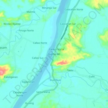
Name: Gattaran topographic map, elevation, terrain.

Location: Gattaran, Cagayan, Cagayan Valley, 3508, Philippines (18.02033 121.60149 18.10033 121.68149)

Average elevation: 16 m

Minimum elevation: -1 m

Maximum elevation: 110 m

Gear up for your next adventure:

🧊Insulated Water Bottle - Keeps drinks cold in summer and prevents freezing in winter
🛁Quick-Dry Microfiber Towel - Space-saving towel that dries rapidly on the move
🧥Softshell Hiking Jacket - The perfect balance of wind protection and breathability
🥾Trail Running Shoes - Lightweight and durable shoes for trail running
🧶550 Survival Paracord - Versatile utility cord for emergency repairs and rigging

As an Amazon Associate, this site earns from qualifying purchases at no extra cost to you.