Geolocate

Sukaraja topographic map

Click on the map to display elevation.

About this map

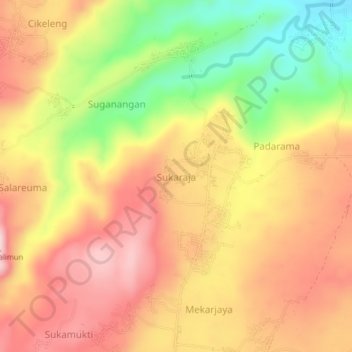
Name: Sukaraja topographic map, elevation, terrain.

Location: Sukaraja, West Java, Indonesia (-6.95129 108.55749 -6.91129 108.59749)

Average elevation: 214 m

Minimum elevation: 59 m

Maximum elevation: 325 m

Gear up for your next adventure:

🛰️Satellite Messenger - Emergency communication for areas with no cell service
🧢Sun Hat - Wide-brim hat for sun protection
Lightweight Camping Tent - Portable shelter optimized for Canadian backcountry camping
🥾Approach Boots - Comfortable boots for hiking and climbing approaches
🥾Hiking Shoes - Durable and comfortable shoes for trail hiking

As an Amazon Associate, this site earns from qualifying purchases at no extra cost to you.