Geolocate

El Bayu topographic map

Click on the map to display elevation.

About this map

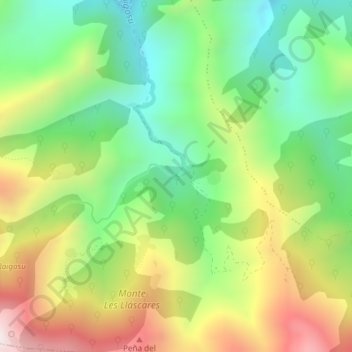
Name: El Bayu topographic map, elevation, terrain.

Location: El Bayu, Villoria, Laviana, Asturias, Spain (43.17067 -5.54284 43.19067 -5.52284)

Average elevation: 891 m

Minimum elevation: 522 m

Maximum elevation: 1,430 m

Gear up for your next adventure:

🥾Mountain Hiking Shoes - Shoes with superior grip for mountainous terrain
🧥Waterproof Pants - Keep dry during rainy hiking conditions
🥫Freeze-Dried Meals - Lightweight, high-calorie nutrition for multi-day treks
🧥Softshell Jacket - Windproof and breathable jacket for hiking
🦯Trekking Poles - Reduced impact on joints for steep topographic climbs

As an Amazon Associate, this site earns from qualifying purchases at no extra cost to you.