Geolocate

El Caliero topographic map

Click on the map to display elevation.

About this map

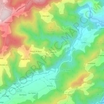
Name: El Caliero topographic map, elevation, terrain.

Location: El Caliero, Selgas, Pravia, Asturias, 33120, España (43.46232 -6.17065 43.50232 -6.13065)

Average elevation: 192 m

Minimum elevation: 12 m

Maximum elevation: 477 m

Gear up for your next adventure:

🧢Hiking Hat - Sun-protective and breathable hats for long treks
🧼Biodegradable Camp Soap - Environmentally friendly cleaning for gear and body
🧥Waterproof Pants - Keep dry during rainy hiking conditions
🛌Down Sleeping Bag - Superior warmth-to-weight ratio for cold nights
🥾Lightweight Hiking Boots - Boots for comfort and mobility on long hikes

As an Amazon Associate, this site earns from qualifying purchases at no extra cost to you.