Geolocate

Owaka topographic map

Click on the map to display elevation.

About this map

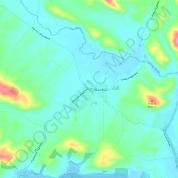
Name: Owaka topographic map, elevation, terrain.

Location: Owaka, Clutha District, Otago, 9535, New Zealand (-46.47068 169.63952 -46.43068 169.67952)

Average elevation: 27 m

Minimum elevation: -2 m

Maximum elevation: 111 m

Other topographic maps

Click on a map to view its topography, its elevation and its terrain.

Waipori River

New Zealand > Otago > Clutha District

Average elevation: 330 m

Ōwaka River

New Zealand > Otago > Clutha District

Average elevation: 179 m

Tahakopa River

New Zealand > Otago > Clutha District

Average elevation: 244 m

Gear up for your next adventure:

💧Collapsible Water Bottle - Space-saving water bottle for outdoor activities
🧳Compression Sacks - Maximize space in your backpack by shrinking gear
🥾Light Trekking Boots - Supportive boots for multi-day treks
💡LED Headlamp - Hands-free illumination for night hiking and camping
🧥Thermal Fleece Jacket - Versatile insulation for changing mountain temperatures

As an Amazon Associate, this site earns from qualifying purchases at no extra cost to you.