Geolocate

Lauricocha topographic map

Click on the map to display elevation.

About this map

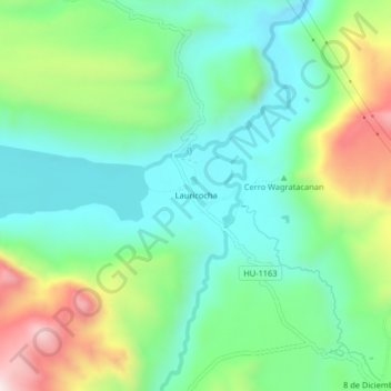
Name: Lauricocha topographic map, elevation, terrain.

Location: Lauricocha, San Miguel de Cauri, Lauricocha, Huánuco, Perú (-10.33550 -76.67859 -10.29550 -76.63859)

Average elevation: 4,002 m

Minimum elevation: 3,819 m

Maximum elevation: 4,402 m

Gear up for your next adventure:

🧣Merino Neck Gaiter - Protects against wind, sun, and cold at high altitudes
🥾Waterproof Hiking Boots - Essential footwear for rugged terrain and wet Canadian trails
🧥Softshell Jacket - Windproof and breathable jacket for hiking
🎒Fully Waterproof Backpack - Total protection for photography gear and electronics
🩹Moleskin Blister Pads - Direct protection for painful foot pressure points

As an Amazon Associate, this site earns from qualifying purchases at no extra cost to you.