Geolocate

Abbot Mount topographic map

Click on the map to display elevation.

About this map

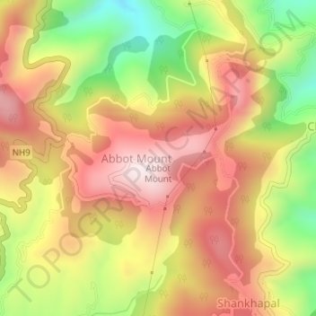
Name: Abbot Mount topographic map, elevation, terrain.

Location: Abbot Mount, Lohaghat, Champawat, Uttarakhand, 262525, India (29.42818 80.10889 29.42828 80.10899)

Average elevation: 1,794 m

Minimum elevation: 1,494 m

Maximum elevation: 2,026 m

Gear up for your next adventure:

🧦Hiking Socks - Moisture-wicking and comfortable socks for long hikes
🐕Hiking Dog Pack - Let your canine companion carry their own water and food
🧰Emergency Multi-Tool - Compact multi-tool for outdoor survival
🛌Down Sleeping Bag - Superior warmth-to-weight ratio for cold nights
Tent Footprint - Protect tent floor and increase durability

As an Amazon Associate, this site earns from qualifying purchases at no extra cost to you.