
Rio Intag topographic map
Interactive map
Click on the map to display elevation.
About this map
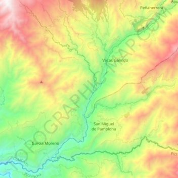
Name: Rio Intag topographic map, elevation, terrain.
Location: Rio Intag, Cotacachi, Imbabura, Ecuador (0.20660 -78.67091 0.35194 -78.51582)
Average elevation: 1,680 m
Minimum elevation: 827 m
Maximum elevation: 2,875 m
Other topographic maps
Click on a map to view its topography, its elevation and its terrain.