Geolocate

Lenno topographic map

Click on the map to display elevation.

About this map

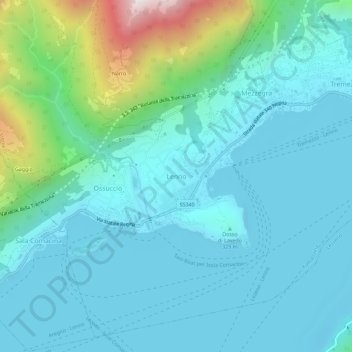
Name: Lenno topographic map, elevation, terrain.

Location: Lenno, Tremezzina, Como, Lombardy, 22016, Italy (45.95298 9.17084 45.99298 9.21084)

Average elevation: 382 m

Minimum elevation: 184 m

Maximum elevation: 1,337 m

Gear up for your next adventure:

🧰Emergency Multi-Tool - Compact multi-tool for outdoor survival
🔪Outdoor Multitool - Versatile tool for repairs and food prep in the wild
🥾Hiking Shoes - Durable and comfortable shoes for trail hiking
🛶Waterproof Dry Bags - Keep electronics and clothes dry during river crossings
🔦LED Flashlight - Powerful and long-lasting flashlight for camping and emergencies

As an Amazon Associate, this site earns from qualifying purchases at no extra cost to you.