Geolocate

Gamasa topographic map

Click on the map to display elevation.

About this map

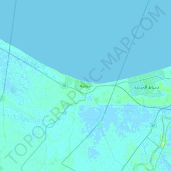
Name: Gamasa topographic map, elevation, terrain.

Location: Gamasa, Ad Dakahliya, 35712, Egypt (31.27883 31.38423 31.59883 31.70423)

Average elevation: 1 m

Minimum elevation: -2 m

Maximum elevation: 16 m

Gear up for your next adventure:

🔭Outdoor Binoculars - Lightweight binoculars for birdwatching and hiking
💡Portable Camping Lamp - Rechargeable lamp for campsite lighting
🧼Travel Hand Sanitizer - Keep hands clean when water is scarce
🥾Hiking Leggings - Comfortable leggings for outdoor activities
🥾Mountain Hiking Boots - High-traction boots for rocky terrain

As an Amazon Associate, this site earns from qualifying purchases at no extra cost to you.