Geolocate

Noumea topographic map

Click on the map to display elevation.

About this map
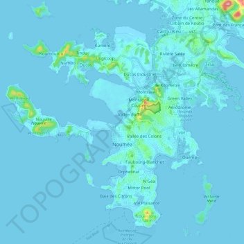
Name: Noumea topographic map, elevation, terrain.

Location: Noumea, South Province, New Caledonia, 98800, France (-22.31253 166.38579 -22.21672 166.50404)

Average elevation: 8 m

Minimum elevation: -4 m

Maximum elevation: 206 m

Gear up for your next adventure:

🚲MTB Frame Bag - Carry tools and maps directly on your bicycle frame
🏕️Camping Hammock - Integrated protection for sleeping between trees
🥾Mountain Hiking Boots - High-traction boots for rocky terrain
🥘Camping Cookware Set - Compact nesting pots and pans for trail cooking
🧥Waterproof Jacket - Lightweight rain jackets for hiking and outdoor activities

As an Amazon Associate, this site earns from qualifying purchases at no extra cost to you.