Geolocate

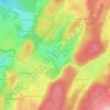
La Semine topographic map

Click on the map to display elevation.

About this map

Name: La Semine topographic map, elevation, terrain.

Location: La Semine, La Pesse, Saint-Claude, Jura, Bourgogne-Franche-Comté, France métropolitaine, 39370, France (46.25434 5.82813 46.29434 5.86813)

Average elevation: 1,216 m

Minimum elevation: 964 m

Maximum elevation: 1,406 m

Other topographic maps

Click on a map to view its topography, its elevation and its terrain.
Gear up for your next adventure:

🧣Evaporative Cooling Towel - Beat the heat during intense summer climbs
🛶Waterproof Dry Bags - Keep electronics and clothes dry during river crossings
💧Hydration Pack - Hands-free hydration system for long hikes
🥾Hiking Leggings - Comfortable leggings for outdoor activities
🧤Thermal Hiking Gloves - Grip-enhanced gloves for cold-weather altitude trekking

As an Amazon Associate, this site earns from qualifying purchases at no extra cost to you.