
Make a donation
Gear up for your next adventure:
As an Amazon Associate, this site earns from qualifying purchases at no extra cost to you.
Aleksa Santic topographic map
Click on the map to display elevation.
Make a donation
Gear up for your next adventure:
As an Amazon Associate, this site earns from qualifying purchases at no extra cost to you.
About this map
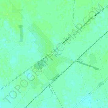
Name: Aleksa Santic topographic map, elevation, terrain.
Average elevation: 120 m
Minimum elevation: 115 m
Maximum elevation: 125 m
Make a donation
Gear up for your next adventure:
As an Amazon Associate, this site earns from qualifying purchases at no extra cost to you.
Other topographic maps
Click on a map to view its topography, its elevation and its terrain.
Bogojevo
Serbia > Vojvodina > West Backa Administrative District > Odzaci Municipality
Average elevation: 83 m
Prigrevica
Serbia > Vojvodina > West Backa Administrative District > Apatin Municipality
Average elevation: 86 m
Make a donation
Gear up for your next adventure:
As an Amazon Associate, this site earns from qualifying purchases at no extra cost to you.
City of Sombor
Serbia > Vojvodina > West Backa Administrative District > City of Sombor
Average elevation: 93 m