
Quartier du Faubourg-du-Roule topographic map
Interactive map
Click on the map to display elevation.
About this map
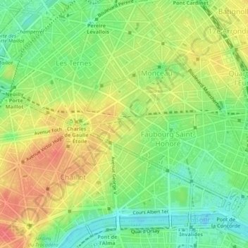
Name: Quartier du Faubourg-du-Roule topographic map, elevation, terrain.
Average elevation: 53 m
Minimum elevation: 25 m
Maximum elevation: 83 m
Other topographic maps
Click on a map to view its topography, its elevation and its terrain.
Gros-Caillou
Frankreich > Île-de-France > Paris
Gros-Caillou, 7e, Paris, Île-de-France, Metropolitanes Frankreich, 75007, Frankreich
Average elevation: 47 m
Jardin des Plantes
Frankreich > Île-de-France > Paris
Jardin des Plantes, 5e, Paris, Île-de-France, Metropolitanes Frankreich, 75005, Frankreich
Average elevation: 47 m