Geolocate

Hamilton topographic map

Click on the map to display elevation.

About this map

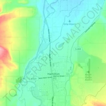
Name: Hamilton topographic map, elevation, terrain.

Location: Hamilton, Ravalli County, Montana, United States (46.23117 -114.18444 46.28958 -114.14004)

Average elevation: 1,097 m

Minimum elevation: 1,064 m

Maximum elevation: 1,186 m

Other topographic maps

Click on a map to view its topography, its elevation and its terrain.

Sky Pilot

United States > Montana > Ravalli County

Average elevation: 2,281 m

Gear up for your next adventure:

🧥Packable Rain Jacket - Breathable waterproof layer for unpredictable weather
🔥Emergency Fire Starter - Reliable ignition source for all weather conditions
🧦Hiking Socks - Moisture-wicking and comfortable socks for long hikes
🧦Thermal Socks - Warm socks for winter hiking or camping
🧢Hiking Sun Hat - Wide-brimmed protection for exposed mountain ridges

As an Amazon Associate, this site earns from qualifying purchases at no extra cost to you.