Geolocate

Portland topographic map

Click on the map to display elevation.

About this map

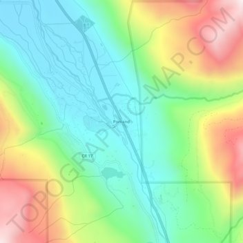
Name: Portland topographic map, elevation, terrain.

Location: Portland, Ouray County, Colorado, United States (38.06138 -107.72145 38.10138 -107.68145)

Average elevation: 2,478 m

Minimum elevation: 2,175 m

Maximum elevation: 3,041 m

Gear up for your next adventure:

🥾Mountain Hiking Shoes - Shoes with superior grip for mountainous terrain
🌬️Windproof Camp Stove - Efficient cooking even on exposed mountain peaks
🛶Kayak Dry Bag - Waterproof storage for kayaking adventures
🧤Thermal Hiking Gloves - Grip-enhanced gloves for cold-weather altitude trekking
🥫Freeze-Dried Meals - Lightweight, high-calorie nutrition for multi-day treks

As an Amazon Associate, this site earns from qualifying purchases at no extra cost to you.