Geolocate

Mainpuri topographic map

Click on the map to display elevation.

About this map

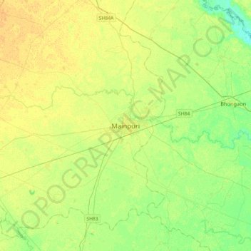
Name: Mainpuri topographic map, elevation, terrain.

Location: Mainpuri, Mainpuri District, Uttar Pradesh, 205001, India (27.06707 78.86717 27.38707 79.18717)

Average elevation: 157 m

Minimum elevation: 146 m

Maximum elevation: 165 m

Gear up for your next adventure:

🚲Heavy Duty Bike Lock - Secure your bike at the trailhead or during stops
🕯️Camping Lantern - Illuminates your entire campsite with high-efficiency LEDs
🥾Mountain Hiking Shoes - Shoes with superior grip for mountainous terrain
🧥Thermal Fleece Jacket - Versatile insulation for changing mountain temperatures
💧Reusable Water Bottle - Durable water bottles for hydration on trails

As an Amazon Associate, this site earns from qualifying purchases at no extra cost to you.