Geolocate

Reinheim topographic map

Click on the map to display elevation.

About this map

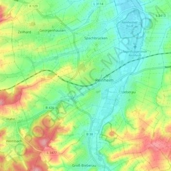
Name: Reinheim topographic map, elevation, terrain.

Location: Reinheim, Landkreis Darmstadt-Dieburg, Hesse, 64354, Germany (49.79617 8.78061 49.85608 8.87005)

Average elevation: 191 m

Minimum elevation: 150 m

Maximum elevation: 264 m

Gear up for your next adventure:

Backpacking Tent - Lightweight tent for long-distance hiking trips
🧤Thermal Hiking Gloves - Grip-enhanced gloves for cold-weather altitude trekking
👟Sport Hiking Sandals - Breathable footwear for water crossings and camp rest
🔪Outdoor Multitool - Versatile tool for repairs and food prep in the wild
🧥Insulated Jacket - Keep warm in cold outdoor conditions

As an Amazon Associate, this site earns from qualifying purchases at no extra cost to you.