Geolocate

Tehuixtla topographic map

Click on the map to display elevation.

About this map

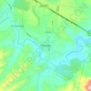
Name: Tehuixtla topographic map, elevation, terrain.

Location: Tehuixtla, Jojutla, Morelos, 62910, Mexico (18.52049 -99.31062 18.60049 -99.23062)

Average elevation: 916 m

Minimum elevation: 831 m

Maximum elevation: 1,184 m

Gear up for your next adventure:

🔋Lithium AA Batteries - Long-lasting power that performs in extreme cold
🧥Fleece Jacket - Warm and lightweight jacket for layering
🦶Anti-Blister Balm - Prevents friction and hotspots during long ascents
❄️Traction Ice Cleats - Slip-on spikes for icy trails and winter hiking
💧Filtered Water Bottle - Safe drinking water on the go

As an Amazon Associate, this site earns from qualifying purchases at no extra cost to you.