Geolocate

Engenthal topographic map

Click on the map to display elevation.

About this map
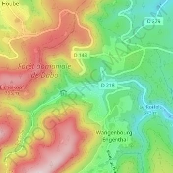
Name: Engenthal topographic map, elevation, terrain.

Location: Engenthal, Wangenbourg-Engenthal, Molsheim, Bas-Rhin, Collectivité européenne d'Alsace, Grand Est, France métropolitaine, 67710, France (48.61424 7.27811 48.65424 7.31811)

Average elevation: 530 m

Minimum elevation: 317 m

Maximum elevation: 816 m

Other topographic maps

Click on a map to view its topography, its elevation and its terrain.

Gear up for your next adventure:

🧥Packable Rain Jacket - Breathable waterproof layer for unpredictable weather
🧢Outdoor Cap - Protective cap for sun and rain during hikes
🧦Crew Hiking Socks - Comfortable socks for long-distance hikes
🧥Ultralight Puffy Jacket - Maximum warmth that packs down to the size of an orange
🐕Hiking Dog Pack - Let your canine companion carry their own water and food

As an Amazon Associate, this site earns from qualifying purchases at no extra cost to you.