Geolocate

Huadquiña topographic map

Click on the map to display elevation.

About this map

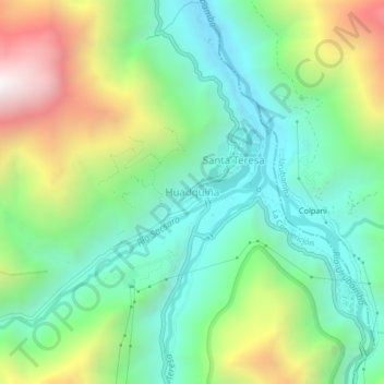
Name: Huadquiña topographic map, elevation, terrain.

Location: Huadquiña, Santa Teresa, La Convención, Cusco, 08680, Perú (-13.15351 -72.61870 -13.11351 -72.57870)

Average elevation: 1,879 m

Minimum elevation: 1,410 m

Maximum elevation: 2,824 m

Gear up for your next adventure:

🛌Insulated Sleeping Pad - Critical thermal barrier between you and the cold ground
🛶Kayak Accessories - Essential gear for safe and fun kayaking adventures
🥾Trekking Boots - Durable boots for long-distance trekking
🔭Compact Binoculars - Lightweight optics for scouting trails and wildlife
🥾Lightweight Hiking Shoes - Comfortable shoes for day hikes

As an Amazon Associate, this site earns from qualifying purchases at no extra cost to you.